Drones in Meteorology: The Flying Weather Laboratories
How unmanned aerial vehicles are transforming meteorological observation and research by collecting atmospheric data in locations too dangerous, remote, or expensive for manned aircraft and ground stations. Covers the types of meteorological drones in use, the sensors they carry for measuring temperature, humidity, pressure, and wind, their role in storm chasing and hurricane reconnaissance, urban weather monitoring applications, and the regulatory and technical challenges still being overcome.
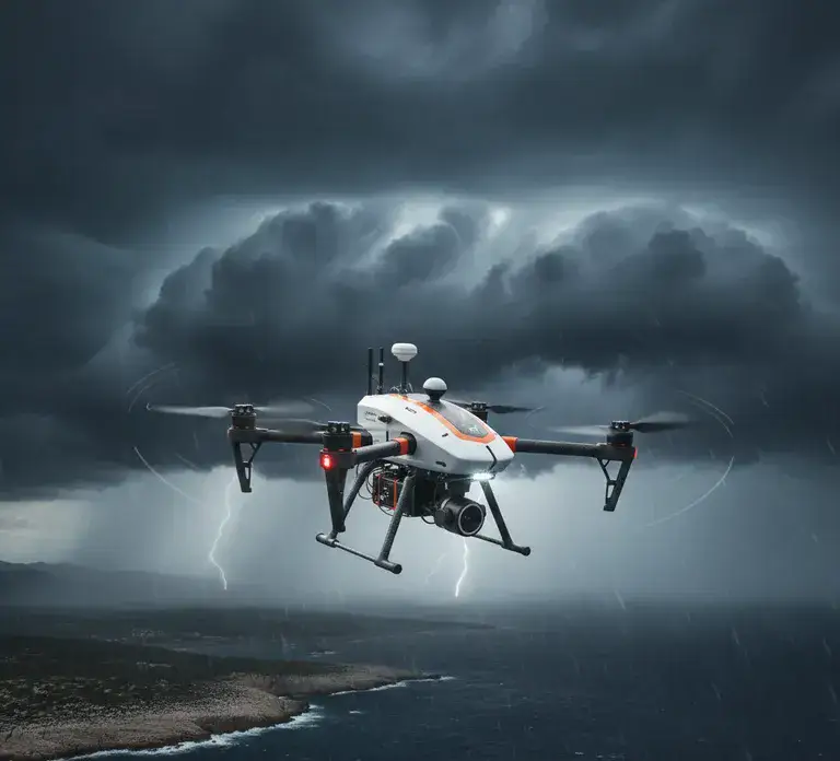
For over a century, weather observation relied on two fundamentally limited perspectives: looking down from satellites thousands of kilometers above, and looking up from ground stations rooted to fixed locations. Between these two views lies the atmospheric boundary layer — the lowest 1-3 kilometers where most weather that affects human life actually occurs — and this critical zone has remained chronically undersampled. Drones are changing this. Unmanned aerial vehicles equipped with miniaturized sensors are filling the observational gap that has plagued meteorology since its inception, providing detailed, targeted atmospheric profiles that neither satellites nor ground stations can deliver.
TL;DR: Meteorological drones fill the critical observation gap between ground stations and satellites in the lower atmosphere (0-3 km). They carry sensors measuring temperature, humidity, pressure, wind, and aerosols at a fraction of the cost of radiosondes or crewed aircraft. Applications include storm chasing, urban heat mapping, wildfire monitoring, and improving forecast models. The technology is advancing rapidly but faces regulatory and airspace integration challenges.
0-3 km
The undersampled atmospheric boundary layer that drones explore
1/10th
Cost of a drone profile vs. a radiosonde launch
10 Hz
Sampling rate of modern drone-mounted atmospheric sensors
5 km
Maximum altitude for standard multirotor weather drones
Drones equipped with miniaturized sensors are filling the observation gap in the lower atmosphere
The Observation Gap Problem
Weather satellites excel at broad coverage — they monitor cloud patterns, sea surface temperatures, and atmospheric moisture across entire hemispheres. Ground stations provide precise, continuous measurements at fixed points. But the atmosphere between the surface and satellite altitude — particularly the boundary layer where thermals, inversions, fog, and low-level wind shear develop — remains poorly sampled. Radiosondes (weather balloons) provide profiles through this zone, but they launch from only about 900 stations worldwide, twice daily, and drift with the wind, providing no spatial targeting capability.
This gap matters because the boundary layer is where forecast models have the largest errors. Temperature inversions that trap pollution, wind shear that endangers aircraft, moisture gradients that determine whether storms form — all of these occur in the lowest few kilometers and are inadequately represented in forecast models. Every improvement in boundary layer observation translates directly into better short-term forecasts for the weather events that most affect daily life.
The problem is particularly acute over oceans, developing nations, and complex terrain where ground station networks are sparse. A single radiosonde launch costs $200-400 including the disposable instrument and helium, limiting their use to well-funded national weather services. The result is a global observation network with enormous blind spots — the majority of the planet's atmospheric boundary layer is sampled rarely or never.
What Drones Carry and Measure
Modern meteorological drones carry sensor payloads measuring temperature (thermocouples and resistance thermometers accurate to 0.1°C), humidity (capacitive hygrometers), pressure (barometric altimeters), wind speed and direction (either dedicated anemometers or derived from the drone's flight controller data), and increasingly aerosol concentration and composition. Some platforms carry miniaturized LIDAR or sodar systems for remote sensing of atmospheric structure beyond the drone's immediate location.
The critical advantage over radiosondes is repeatability and targeting. A drone can fly the same vertical profile multiple times per hour at a precise location, capturing the rapid evolution of boundary layer structure that a single balloon launch would miss. It can be directed to investigate specific features — a temperature inversion, a developing cumulus tower, the outflow boundary of a nearby thunderstorm — rather than simply ascending passively wherever the wind takes it.
Wind measurement from drones deserves special attention because it required solving a non-obvious engineering problem. A radiosonde measures wind by tracking its GPS position as it drifts — the wind carries it. A drone actively fights the wind to maintain position. The solution: multi-hole pressure probes mounted on booms measure airflow directly, or algorithms analyze the drone's motor power and tilt angle to infer the wind speed and direction it is compensating for. Both approaches now achieve accuracy within 0.5 m/s of traditional instruments, making drone wind profiles operationally useful.
Severe Storm and Hurricane Reconnaissance
Some of the most valuable meteorological drone applications involve flying into environments too dangerous for human observers. Several research groups now deploy drones directly into the environments surrounding severe thunderstorms. The University of Oklahoma's CopterSonde and similar platforms have measured the warm, moist inflow feeding supercell thunderstorms — data previously obtainable only by driving instrumented vehicles dangerously close to tornadoes. Drones can sample the atmosphere at multiple altitudes ahead of a storm, revealing the vertical thermodynamic profile that determines whether a storm will produce tornadoes, hail, or merely heavy rain.
Hurricane reconnaissance represents perhaps the highest-stakes application. While NOAA's Hurricane Hunters (crewed P-3 aircraft) have flown into hurricanes since the 1940s, they operate at altitudes above 3,000 meters and cannot safely sample the lowest, most intense layers near the ocean surface. Drones — expendable and unpiloted — can descend into the hurricane boundary layer where wind speeds exceed 250 km/h and sea spray reduces visibility to meters. Data from this zone is critical for intensity forecasting: the transfer of heat and moisture from ocean to atmosphere in the lowest 500 meters drives hurricane intensification, and this process has been almost impossible to observe directly until drones made it feasible.
The US military's Coyote drone, air-launched from Hurricane Hunter aircraft, has successfully operated inside major hurricanes, transmitting temperature, pressure, humidity, and wind data from altitudes that no crewed aircraft could safely reach. These observations have already improved understanding of rapid intensification events — the sudden strengthening of hurricanes that makes them so deadly — by revealing boundary layer structures that satellite and aircraft data could only infer.
Applications Transforming Forecasting
Urban meteorology is perhaps the most promising civilian application. Cities create their own microclimates — heat islands, canyon winds, pollution domes — that traditional observation networks cannot resolve. Drones flying systematic grid patterns over urban areas can map temperature variations block by block, identify pollution hotspots, and measure the urban boundary layer structure that determines how efficiently a city ventilates and cools at night. Research in Tokyo, Phoenix, and Athens has revealed temperature differences of 5-8°C within single neighborhoods — variations invisible to the nearest weather station but critical for public health during heatwaves.
Wildfire monitoring has become another critical application. Drones equipped with thermal cameras and atmospheric sensors can map fire perimeters, measure smoke plume heights and transport directions, and sample the extreme temperature gradients near fire fronts that drive erratic fire behavior. This data feeds directly into fire behavior models that help incident commanders predict fire spread and plan evacuations. In the Mediterranean — where wildfire seasons are lengthening due to climate change — drone-based fire weather monitoring is transitioning from research tool to operational necessity.
Agricultural meteorology benefits from drone profiling in ways that directly affect food production. Temperature inversions that cause frost damage to orchards and vineyards occur in the lowest 50-100 meters — a zone invisible to standard weather stations. Drones can map inversion layers across agricultural landscapes, identifying which fields are at frost risk and which are protected. Wine producers in France and California are already using drone atmospheric profiles to time frost protection measures with precision that saves millions in crop losses annually.
Challenges and Limitations
Battery life remains the primary constraint for multirotor drones — most platforms operate for 30-60 minutes, limiting vertical range and flight time. Fixed-wing drones offer longer endurance (2-4 hours) but cannot hover for stationary profiles. Regulatory frameworks in most countries restrict drone operations near airports, above certain altitudes, and beyond visual line of sight, all of which limit meteorological applications. Integration into controlled airspace — essential for routine high-altitude atmospheric profiling — remains an evolving regulatory challenge.
Sensor accuracy in the rotor wash environment presents technical challenges. The turbulence created by spinning rotors can affect temperature and humidity readings if sensors are not properly shielded and positioned. Research has shown that placing sensors on booms extending above or below the rotor plane, combined with aspiration shields, largely solves this problem, but standardization of sensor placement and calibration across platforms remains a work in progress.
Data integration poses a systemic challenge. Weather forecast models are designed to assimilate data from standardized sources — radiosondes, surface stations, satellites — with well-characterized error profiles. Drone data comes from diverse platforms with varying sensor quality, calibration standards, and flight patterns. Developing the data assimilation techniques to incorporate this heterogeneous data stream into operational forecast models is a major ongoing research effort at weather services worldwide.
The Future: Autonomous Weather Networks
The trajectory of meteorological drone technology points toward fully autonomous observation networks. The concept: arrays of drones stationed at distributed locations, programmed to launch, profile, and land without human intervention based on signals from forecast models. When a model detects that forecast skill is degrading in a particular area — perhaps a developing storm system or an unusual temperature pattern — it requests additional observations, and the nearest drone launches to fill the data gap.
This "model-directed observation" approach represents a fundamental shift from scheduled observation (launching radiosondes at fixed times regardless of conditions) to adaptive observation (observing where and when the forecast needs it most). Prototype systems are already operating in limited trials: the US Department of Energy's Atmospheric Radiation Measurement program operates semi-autonomous drone networks at research sites in Oklahoma and Alaska, with drones launching at model-determined intervals.
The economics favor rapid scaling. A fully equipped weather drone costs $5,000-20,000 — comparable to a single year of radiosonde launches from one station. A network of 100 autonomous drone stations across a country would cost less than a single weather radar installation while providing atmospheric profiles at spatial density no other technology can match. Within a decade, weather services that today launch balloons twice daily from a few dozen stations may operate hundreds of drone stations providing continuous boundary layer monitoring.
The Mediterranean Opportunity: The Mediterranean basin is one of the world's most observation-sparse regions relative to its meteorological complexity. Warm sea surfaces, mountain barriers, and continental-maritime air mass collisions create rapidly evolving weather that current observation networks cannot adequately capture. Drone networks positioned along Mediterranean coastlines — particularly in Greece, Turkey, and the Adriatic — could fill critical observation gaps for flash flood forecasting, wildfire weather prediction, and severe storm detection in a region where these hazards cause billions in annual damage.
Observation Paradox: The atmospheric conditions most urgently needing drone observations — severe storms, high winds, icing conditions — are precisely the conditions most dangerous for drone operations. The boundary layer is most scientifically interesting when it is most violent: during strong convection, intense wind shear, and rapid destabilization. Engineering drones that can operate safely in the conditions they are designed to observe is the central challenge of meteorological drone development — and the reason expendable drones, designed to be lost in extreme conditions, may be the pragmatic solution.
Drone atmospheric profiles at 1/10th the cost of radiosondes could enable 10x denser observation networks in data-sparse regions
Urban heat island mapping by drones is revealing temperature differences of 5-8°C within single city blocks
Wildfire drones now provide real-time smoke plume data that feeds directly into air quality forecast models
The next frontier is autonomous drone networks that launch, profile, and land without human intervention based on forecast model needs
Drones represent the most significant advance in atmospheric observation since the weather satellite. By filling the critical gap between surface stations and space-based sensors, they are providing the data that forecast models have always needed but never had — detailed, targeted profiles of the atmospheric boundary layer where weather that matters to humans actually happens. From hurricane reconnaissance to urban heat mapping, from wildfire monitoring to frost protection, the applications are already transforming how we observe and predict weather. The technology is still maturing, but the trajectory is clear: within a decade, networks of autonomous weather drones will be as fundamental to meteorology as radar and satellites are today. The atmosphere's most important layer will finally be properly observed.